Tatow Knob has been creeping around on my to-do list for years. Ever since I read in Kelsey’s Utah Mountaineering Guide that he hadn’t been able to summit without technical rock climbing gear I was anxious to have a go. Hunter was equally stoked and game for a good West Desert adventure. Rumor was it had never been climbed (summitpost.com). We both seriously doubted it, but countless google searches only turned up nearly zero results- one being a poor picture of my sink… So with winter nipping at our heels it was time to head to the Desert and check it out.
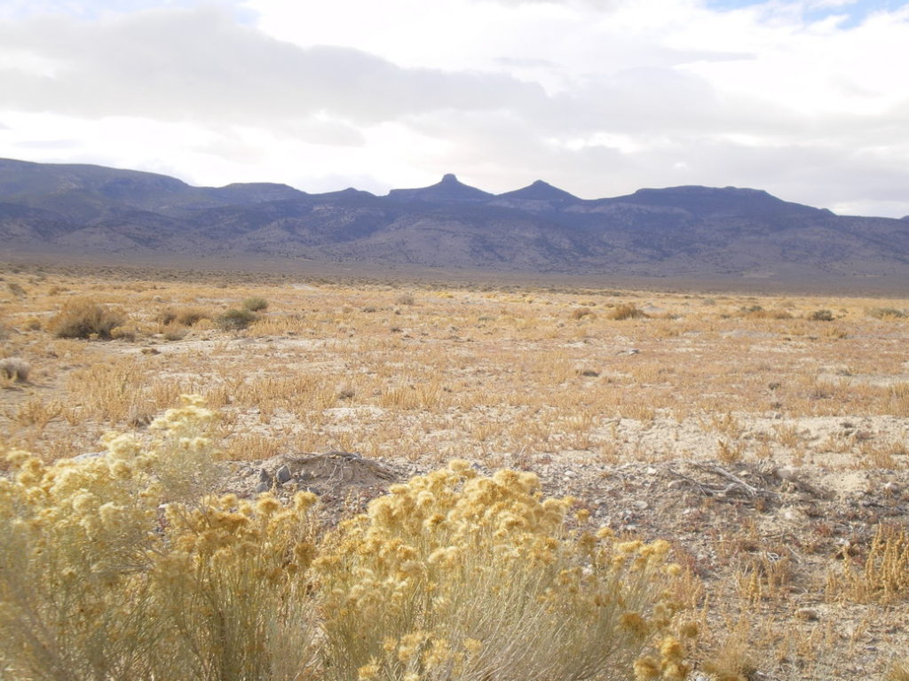
We hit the road after work Thursday night in his endurance machine, the Metro, with explicit promises to be back the next night by 6 p.m. We hit the dirt roads southeast of Delta in the cloak of night and turned our attention to the mileage and Hunter’s dialed-in notes culled from the goldmine that is Google Earth. After some minimal searching (and 30+ miles of dirt road) we caught a weak dirt road off into the colluvium and crashed for the night on a flat chunk of dirt. With a supposedly massive storm brewing the wind blew all night – but was surprisingly warm.
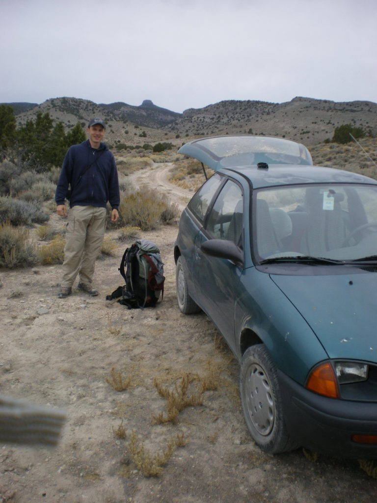
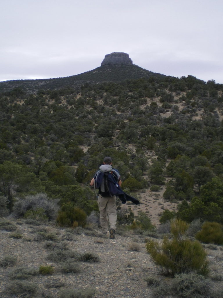
Up before dawn we hit the road as soon as we could make out Tatow on the skyline to confirm we were at least in the ballpark. A few miles further up the road we called it and threw the packs on. From the random maps I had brought it looked like three to four miles as the partridge flies to the knob, so with limited time we set out at a quick clip aiming to fulfill out 6pm promise. But it looked far away… and the weather looked increasingly threatening… and the cliffs of the Knob looked big. I was getting nervous- albeit stoked to be hiking up a canyon the more resembled a southern Utah slot canyon than a Great Basin wash.
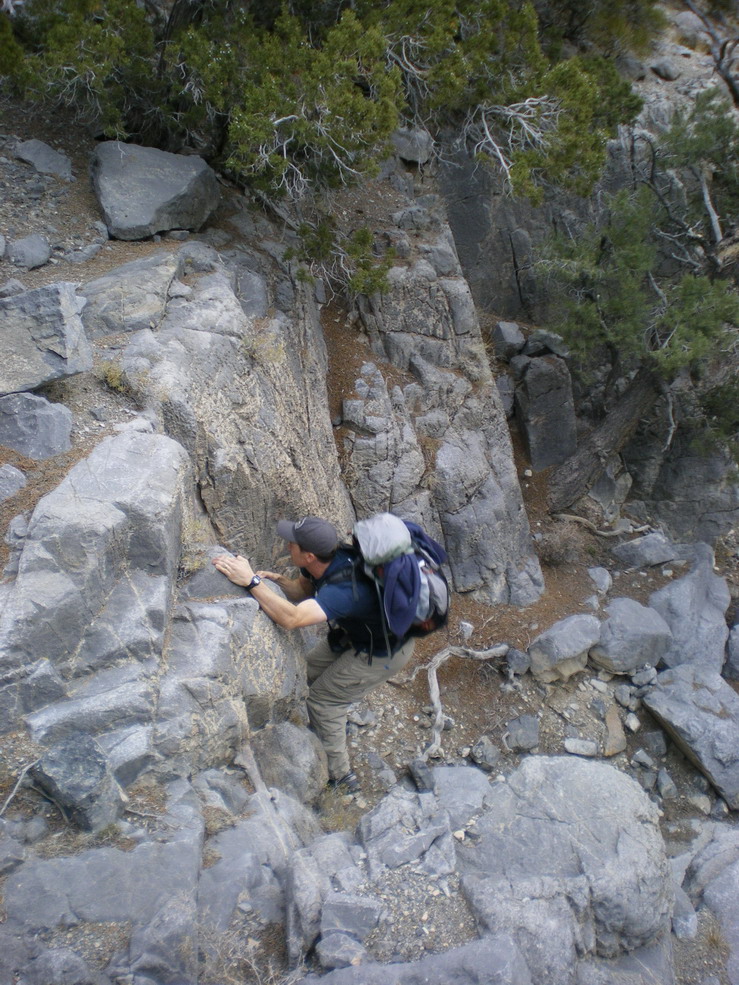
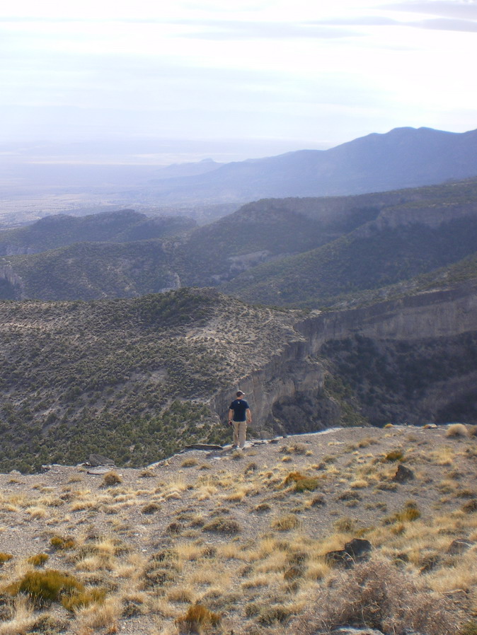
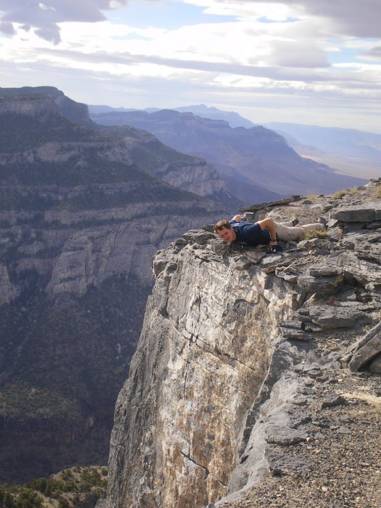
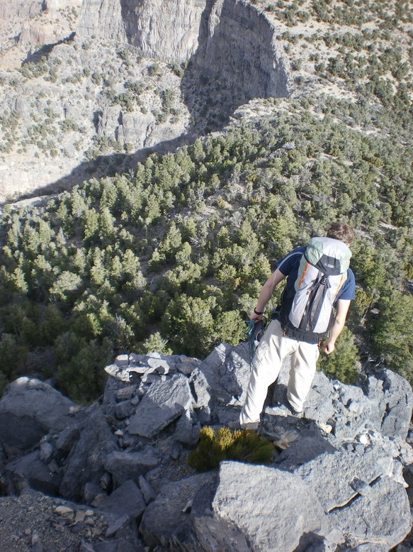
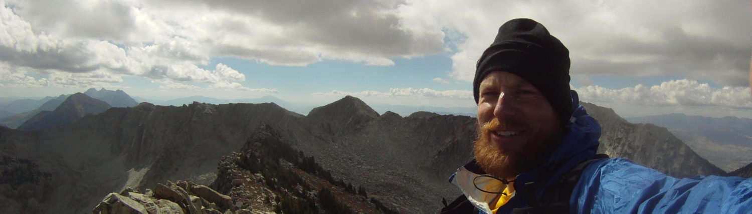
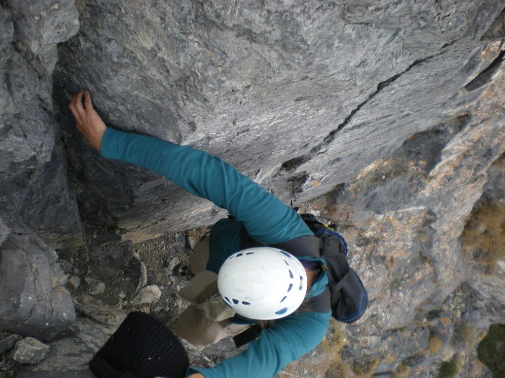
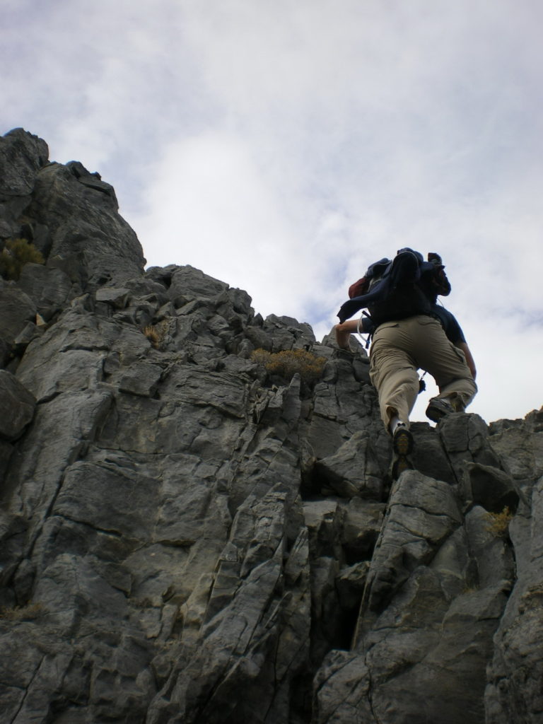
An hour later we were making the final ascent up the ridgeline to the illicit Knob. Its threatening cliffs looked better but then worse as we neared- better because it looked climbable, but worse because it looked like a rotting crouton- slowly crumbling into rubble. Hunter reached it first and started searching for a route and I followed looking for the magic line. We debated a couple of options and then separated again; I headed to the west face and was bummed to find a bud light can tossed in the rubble. I returned to find Hunter soloing up a crumbling rubble ramp. It looked like the obvious path and I followed occasionally horrified by crazy loose rock. We reached a good ledge, and debated breaking out the climbing gear as the lead steepened ahead. Instead we enjoyed the photo op and Hunter disappeared around the corner. I was debating the rickety lead above me when Hunter’s head appeared above, promising an easier path on the right. I traversed right, slowly, feeling out each hold as a fall would have landed me in the Tule Valley morgue. I caught Hunter just shy of the summit plateau as he snapped a few pictures. The enigmatic summit was just a short step away; I made the move and Hunter followed. Turns out the rumors were false. Twenty feet away lay a BLM cadastral survey marker; we didn’t seem to care- just happy to be on a wild summit with unreal views- more like Mars than Earth. Far north to the Fish Springs Range, south to Swasey Peak and Notch Peak, and west into the barren Tule Valley. Amazing.
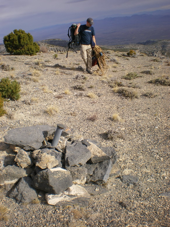
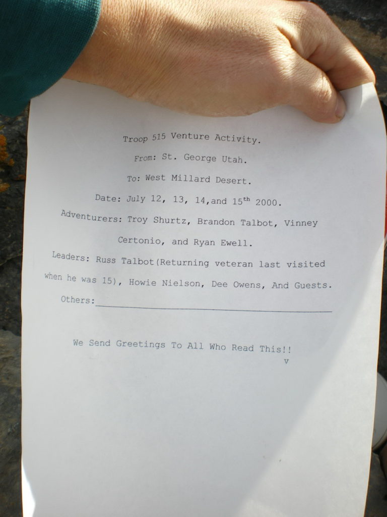
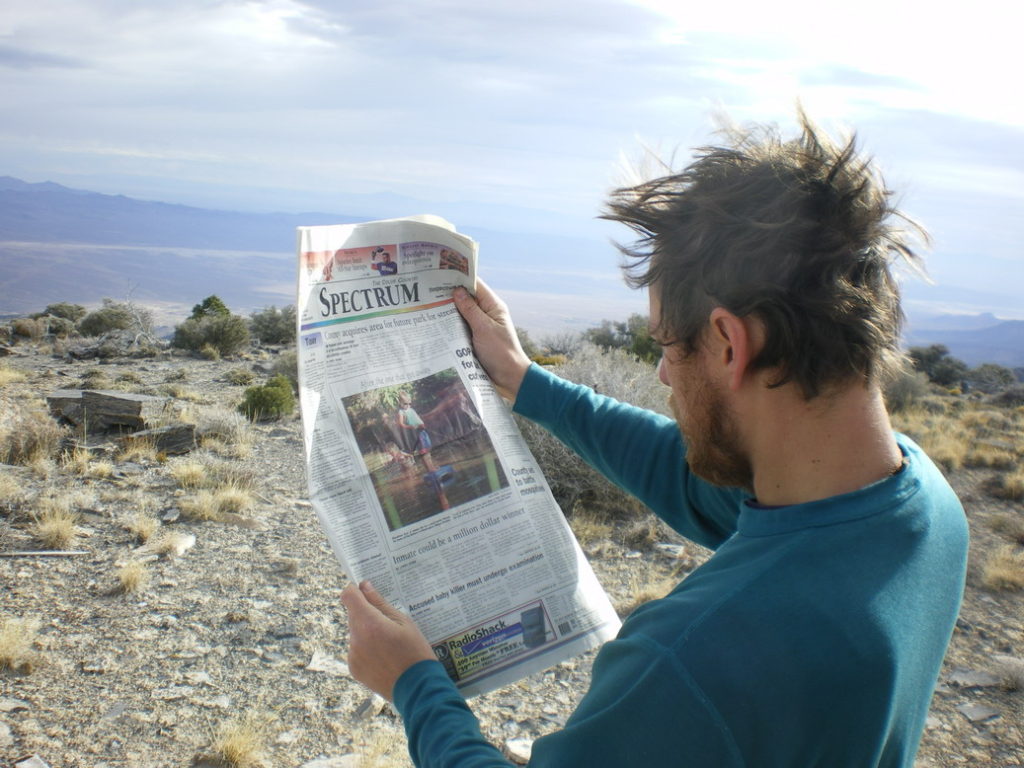
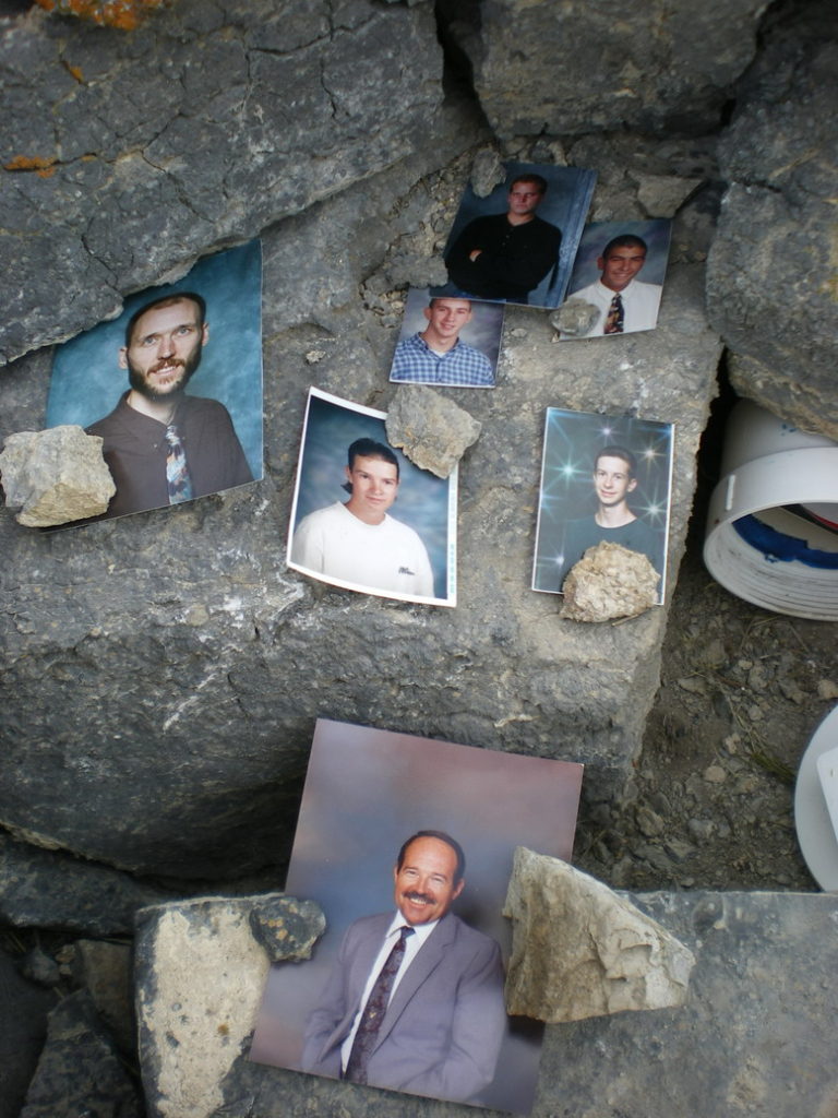
Curious to find the high point we headed towards the western edge finding a large cairn erected by some past heathens. I glanced around and besides another bud light can I saw the glint of white PVC buried in the rubble. A summit registry I thought. Curious to read of any technical ascents I moved the rocks and opened up the watertight registry. I reached in and curiously felt photographs- strange I thought. I pulled them out, along with a newspaper, a cracked CD, and a typed note. It seems the caliber of alpinists who climb Tatow Knob is high. Only true stallions apply (see below!). We were truly proud to share the summit with such lofty companions!
We spent some time scouring the area for anchors, catching some photos, invoking the Beastmaster, and enjoying the summit bliss. Again short on time, we packed up the gear, and slowly downclimbed our ascent route. A quick hike out found us back at the Metro, happy to be off ahead of the rain and ahead of schedule. Overall it was a fine climb. In a world full of excessive information it was fabulous to head out into the semi-unknown with an air of wild mystery. Yeah, it sucked hauling all that climbing gear and not needing it, but it was a small price for a fine adventure. So… to preserve some mystery I’ve purposefully been fairly vague about our actual route, how we got there, and how we conquered. For us the real adventure was the lack of info and it seems right to keep it that way. Email me if you want any additional info.