Chlorine gas, military munitions, ample beef, and short mountains? What’s not to love about the Lakeside Range. I’m not exactly sure – beyond the open space and relative close proximity to my home. And yeah – the lack of people is probably the real reason.
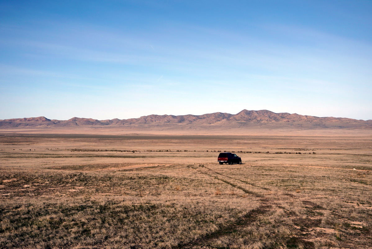
The ‘miniature’ Jedediah Mountain has been on my tick list for quite some time. A previous attempt was scuttled by the most dense mid-winter fog I’ve ever seen while driving out towards the US Mag plant. I ended up scampering up Craner Peak instead – a long time favorite. This current trip was nearly scuttled when my gas gauge suddenly dropped to 1/4 tank after only 40 miles of driving. I ended up buying a couple of gallons of overpriced gas at Delle – which also luckily led me to approaching on the [paved] west side of the Lakeside Range instead of the east.
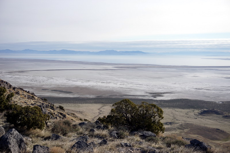
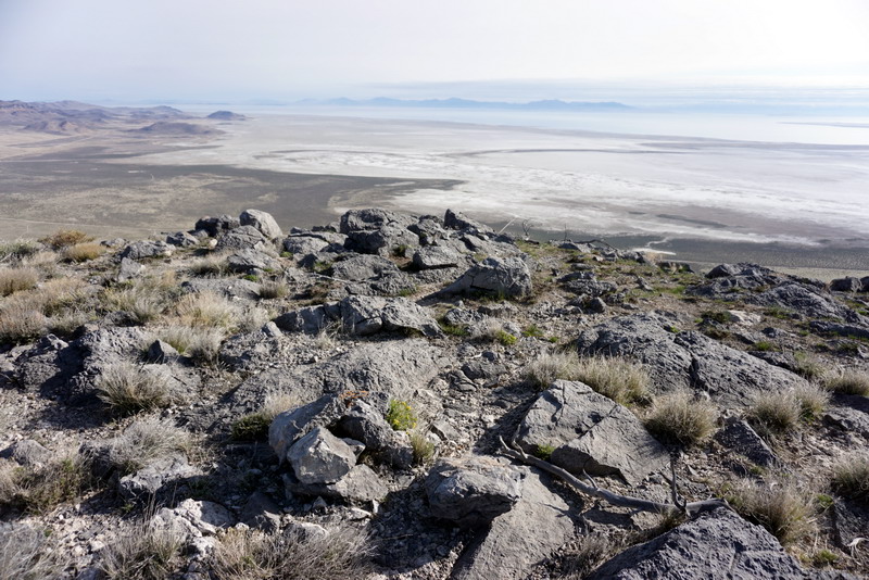
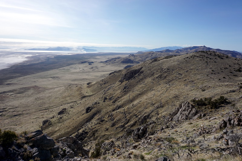
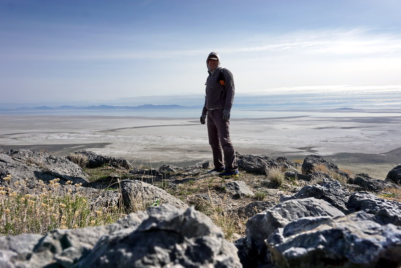
There isn’t much to report in regards to the climb. I left the Puddle Valley highway on a decent dirt road which led to the Well Pass Road which I followed south for a half mile before deciding to stretch my legs. Finally out of the truck, I jogged east, following a random valley up to the rolling south ridge of Jedediah Mountain. The view east into the Great Salt Lake is always a favorite – despite the long pollution plume from the U.S. Mag plant trailing northeast to Antelope Island and Ogden.
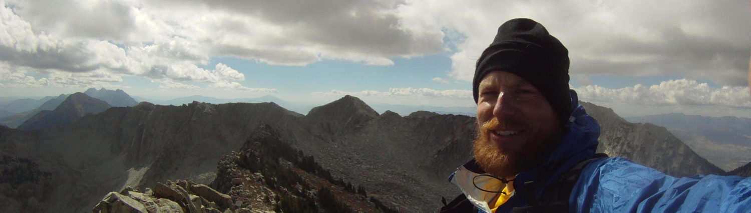
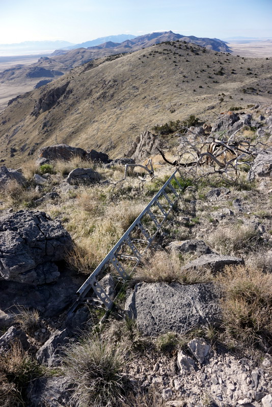
On the summit I found an old aluminum tower that had succumbed to time. I also found a can of sardines and a thermos of coffee in my pack that cut the hunger and the chill. What’s better than coffee in Utah and canned fish overlooking a fish-less inland sea? A very enjoyable summit even if it wasn’t hard won.
Some Notes on the Route
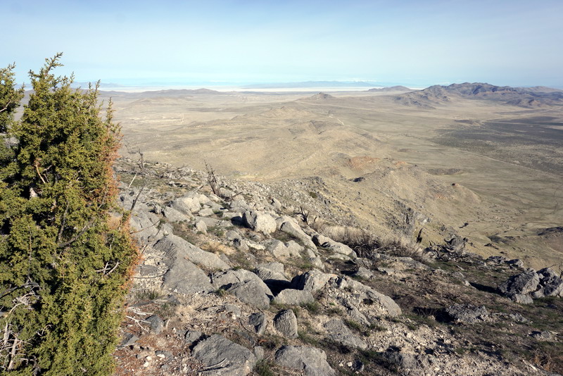
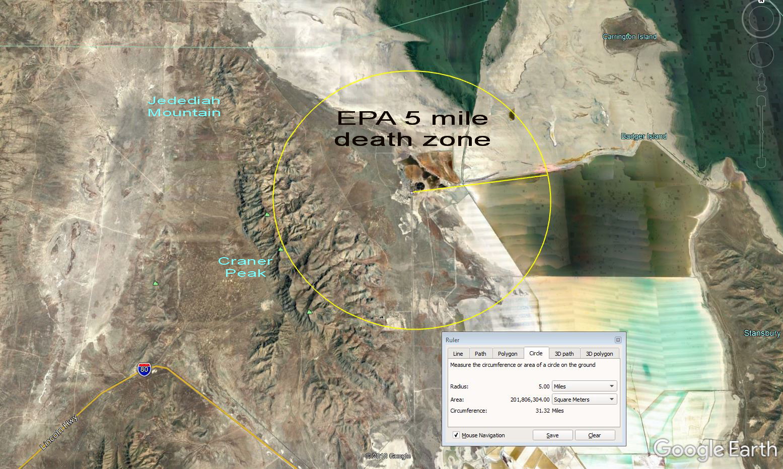
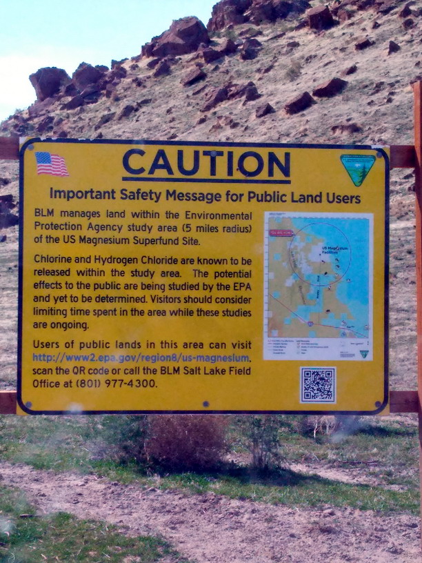
If anyone else really wants to hike/run this peak I’d recommend doing it from the west as I did. Just drive up the Puddle Valley road to the Lakeside Range area and pick a dirt road to follow. The one that I followed was easily passable in a 2WD car. Then just head east to the peak. It’s the only peak in several miles – so route finding is easy. The true west face is craggy – but far from technical. Approaching from the east also looks easy. But my return drive home on the east side of the range towards U.S. Mag was rough given all the cow traffic. The dirt road was trashed and I nearly rammed a few sides of beef. The area around US Mag is some sort of EPA Contamination Study Zone. It’s pretty bad.
Jedediah Mountain: for the love of the geographic name
With an ongoing interest in geographic names and my role on the Utah Committee on Geographic Names I thought it would be interesting to dive into the root of the name of Jedediah Mountain. As most would guess, this mountain is named for perhaps the most famous western Mountain Man – Mr. Jedediah Smith.
The original proposal was made by a Mr. Hellmut H. Doelling in 1964 while he was working on a manuscript for the geology of Box Elder County (1980). The original proposal provides a justification for the name stating “Jedediah Strong Smith [being], the first man to cross the Great Salt Lake Desert (1827)” (source: BGN Files. Minor correction – he was likely the first white man to cross the GSL Desert.
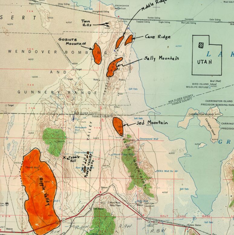
It appears Mr. Doelling originally suggested Jed Mountain but the U.S. Board on Geographic Names responded with Jedediah Mountain – preferring the full name as is their standard policy. The name “Jedediah Mountain” was approved in summer 1964 along with a few other nearby features: Puddle Valley; Puddle Valley Knolls; Cave Ridge; Cobble Hill; Gosiute Mountain; Middle Ridge; Ripple Valley; Sally Mountain (BGN Docket List 64).
All this effort to help Mr. Doelling better orient his pending reader to the landscape and geology of the Lakeside area and Box Elder County in general.
My daughter and I were going to ascend Craner Peak this past weekend but the biting ghats were having a feast on us and the chlorine gas from the US magnesium pollution factory was intense. Instead we continued north on the east side rode through Wrathall Pass and then down on the west side and descended Jedediah Peak. My second time up there in the last 20 years. Thanks for your post as I was always wondering who the peak was named after.
Thanks for the note! I love it out there and was curious about the name as well. Craner is definitely a gem if you make it back out there. Take care!
Arie,
I am interested in Craner Peak in the Lakeside Mountain Range. In this article you mention that you’ve been there a number of times.
My interest is whether there is a rock cairn at the top of it. In 1988 my Uncle Wes Peterson and others hiked there because his father built it almost one hundred years earlier. I attempted to get up the mountain a couple of times but my legs gave out on me. May I ask if it is still intact? I read something a few years ago that indicated there was a damaged cairn at the top. Thank you.
Hi Mike-
Thanks for the interest. I’ve been up Craner a bunch of times and I can confirm there’s a small cairn on the top. I can email you a photo if you’re interested = saltgrey AT gmail DOT com. The cairn on the actual summit is pretty small – like less than a foot tall and consists of ~10-15 smallish limestone rocks. It barely holds the summit register which is a small glass bottle (or at least it was). Down-ridge to the east I remember another possible cairn and a wooden stake (if my memory holds). It’s at least a few hundred feet off the summit to the east and I figured it was a geocache of some sort.
If either of those cairns are over a hundred years old, that is really cool. It would be a major bummer if someone damaged them. Next time I’m up there I’ll look in more detail at the summit area.
Thanks again – best wishes!